


Lake Type: Natural Freshwater Lake, Dammed
Water Level Control: US Army Corps of Engineers
Surface Area: 85,960 acres 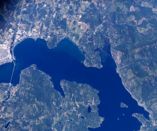
Shoreline Length: 111 miles
Normal Elevation: 2,058 feet
Minimum Elevation: 2,050 feet
Maximum Elevation: 2,063 feet
Average Depth: 538 feet
Maximum Depth: 1,152 feet
Water Volume: 43,939,940 acre ft
Completion Year: 1955
Drainage Area: 24,200 sq.miles
Trophic State: Oligo-mesotrophic
Water to Aquifer: 43 mgd
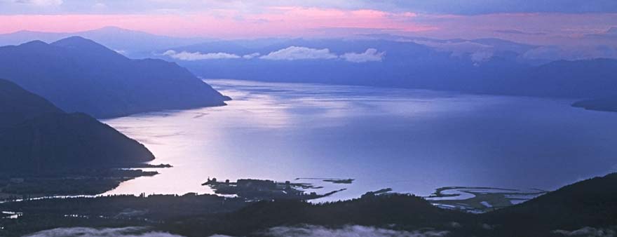
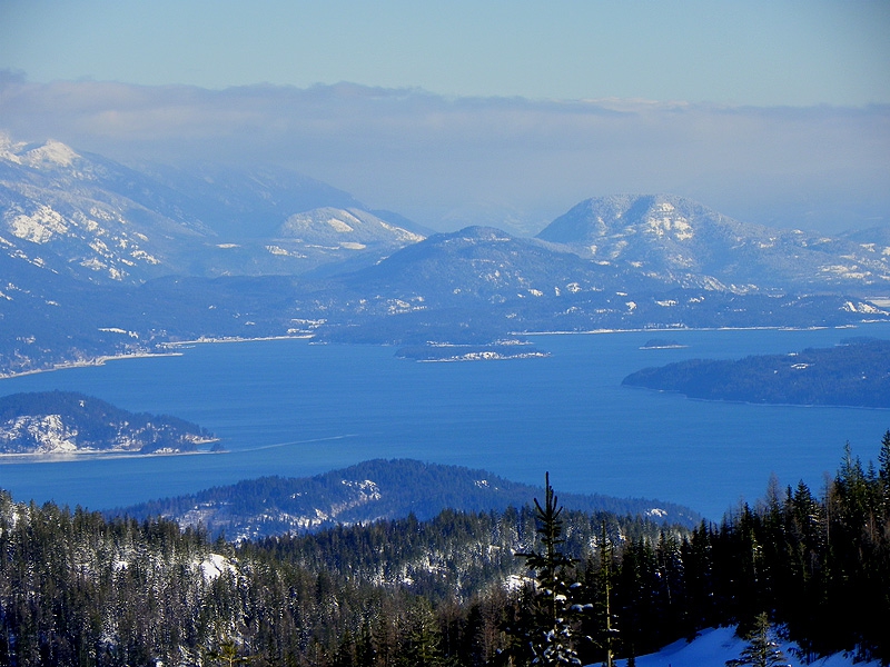
Set in a valley carved by glaciers from Canada, Lake Pend Oreille (pond-a-RAY) is surrounded by mountains that stretch up to altitudes further than 6,000 feet. Plunging to maximum depths over 1,000 feet, the lake is one of the largest and deepest natural lakes in the western United States. Lake Pend Oreille is at the center of the Northern Idaho region characterized by open and expansive scenes
The Kallispel Native Americans (or the Pend d’Oreilles) inhabited the region of the lake before white settlement in the 1800s. The present name of the lake though, was given by a French fur trader. “Pend Oreille” is French for ear hanging or pendant. Not surprisingly, the lake is shaped like a human ear.
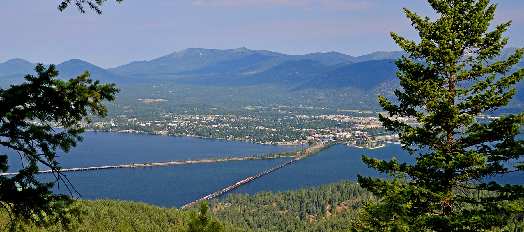
Lake Pend Oreille was significant to the navy during the World War II era; the south end of Lake Pend Oreille was once the second largest naval training station in the United States, the Farragut Naval Training Station. The training station is now today’s Farragut State Park of 4,000 acres but the Navy’s Acoustic Research Detachment still utilizes the lake’s cavernous depths to test large-scale submarines.
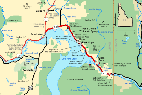
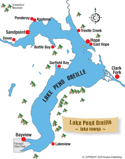
After the war, in 1955, the US Army Corps of Engineers dammed the lake at a natural falls site, Albeni Falls, on the Pend Oreille River. The lake was enlarged as a result, and the dam helped maintain water levels. The project helps to both control flooding and generate hydroelectric power. The 111 miles of mountainous shoreline are spotted by various residential communities
Organizations Protecting Lake Pend Oreille
Bonner Soil and Water Conservation District – Lake Assist
Idaho Conservation League
Kaniksu Land Trust
Lake Pend Oreille, Pend Oreille River, Priest Lake and Priest River Commission
Lake Pend Oreille Waterkeeper Water Quality Monitoring
Pend Oreille River and Tributaries Watershed Advisory Group (WAG) IDEQ
Rock Creek Alliance
Washington Department of Ecology Water Quality Improvement Projects Pend Oreille River Area
Studies, Reports, Articles and Presentations
2007-2017 Clark Fork Pend Oreille Watershed Management Plan
Army Corps of Engineers 2012 Lake Pend Oeille Water Quality Monitoring Plan
1993 Clark Fork Pend Oreille Basin Water Quality Study
USGS Scientific Studies in Northern Idaho – Completed -Identifying and Mapping Potential Kokanee Spawning Habitat in Lake Pend Oreille